Burst of Central US Severe Weather Potential Apr 25-28
- Andrew Pritchard

- Apr 23, 2024
- 1 min read
Updated: May 5, 2024
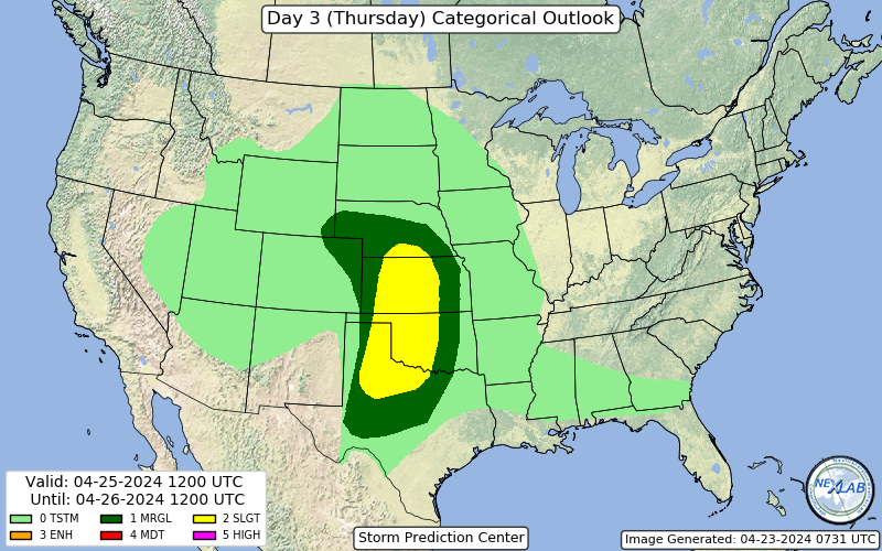
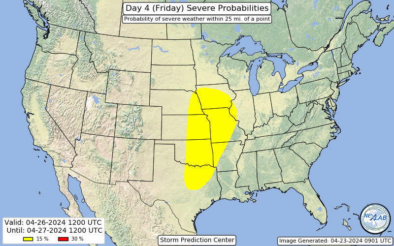
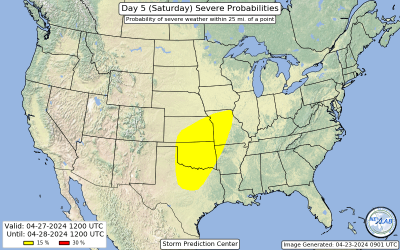
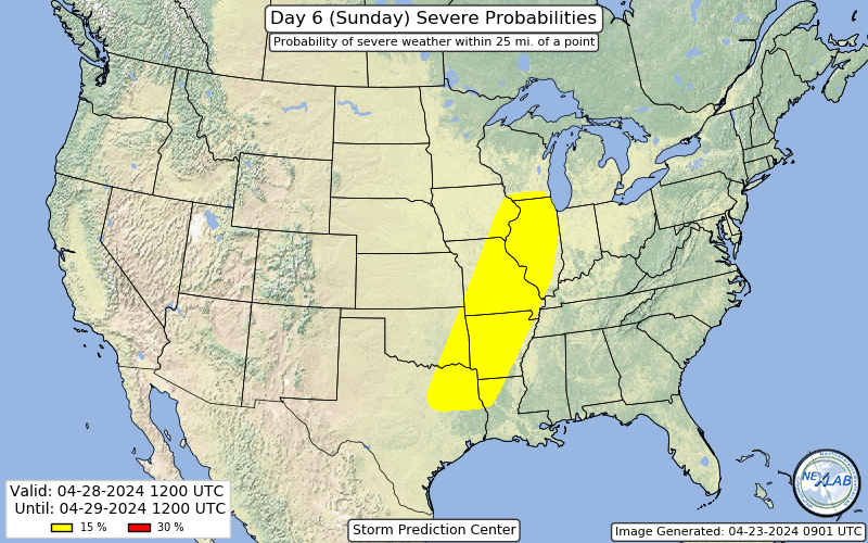
An active stretch of weather is expected across the Central U.S. late-week into the weekend as a pair of high-impact storm systems track from the Plains to the Midwest. The coming period of active weather is expected to peak Thursday through Sunday, April 25-28, though at least isolated severe thunderstorms are possible across pockets of the Plains and Midwest in the days leading up to this window of opportunity.

The first area of low pressure emerges east of the Rockies in southeast Colorado on Thursday. Daytime thunderstorm initiation ahead of this disturbance is in question on Thursday evening, but at least isolated to scattered severe storms are forecast to develop overnight as the storm system begins to lift northeast. A more organized daytime severe weather risk may exist on Friday both near the triple point in Nebraska and Iowa and southward along the dryline into the Red River region of Oklahoma and Texas.
On Saturday, another area of low pressure emerges over the Southern Plains and takes a similar northeastward journey into the Midwest with another multi-day risk for severe weather. Saturday's risk may be highest in the Southern Plains with this second disturbance, but at least isolated severe storms should be possible further north and east along a stationary front extending from Kansas to Indiana. On Sunday, the severe weather risk shifts east but may extend along an impressed north-south line from Milwaukee to Waco.
We really begin speculating as we look beyond Sunday, but the pattern is likely to take at least a brief breather to regroup early next week.


