
Rio Grande Supercells Today

A subtle sub-tropical jet stream disturbance will overspread a moist and strongly unstable warm sector ahead of a sharpening dryline way down on the Rio Grande river this afternoon and evening with a few supercells likely producing significant severe weather from Del Rio to Austin southward into Mexico.
An early morning storm cluster is already severe-warned as it runs down the Interstate 10 corridor on Tuesday morning, and could produce sporadic outflow winds to severe levels along an increasingly organized cold pool and gust front as it pushes toward the San Angelo - Austin corridor through the afternoon and evening.
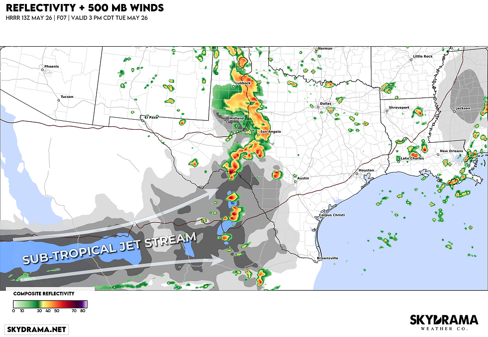

The more interesting part of the setup from a storm observation standpoint is further south along the southern flank of the MCS, down the dryline into Mexico this afternoon and evening.
As this sub-tropical jet stream disturbance overspreads the Rio Grande and Big Bend region a weak surface low will draw deep moisture northwestward from the Gulf beneath a stout EML and steep lapse rates being drawn in from Mexican Plateau. The result should be a strongly unstable environment with ample shear for organizing any robust convection that develops into a couple of intense supercell storms.

The bulk of this activity may stay to the Mexico side of the Rio Grande, but I wouldn't be shocked by a long-lived, intense supercell in the Del Rio vicinity this evening producing giant 3"+ hail and significant straight-line wind gusts over 80 mph in the FFD/RFD region of the supercells. A tornado or two is definitely possible, though getting eyes on it may be tough down there.
Watch the sub-tropical jet stream kiss the dryline and ignite scattered supercells during the afternoon:

The sub-tropical jet stream impulse overspreads the region, drawing a stout EML with steep mid-level lapse rates east from the Mexican Plateau:

The result of all of this should be a couple of semi-discrete supercells from Del Rio to Austin this evening, with a more isolated supercell or two further south down the dryline into Mexico. Good luck, chasers!


