
Significant Wind Bag Possible Today in Illinois and Indiana

Another day, another highly uncertain severe thunderstorm forecast across portions of Illinois and Indiana. Social media has been screaming about a potential derecho with scary simulated radar graphics from high-resolution guidance, and while that does feel like one possible outcome, it ignores the fact that there is very little to no consistency or agreement within those models, either with other models or with their own selves and their most recent forecast. Big changes run to run, and looking closer, no model is really handling ongoing morning storms in Iowa well, either.
So, if you're buying into what the models say, you're accepting a model that starts off wrong, to get it right as it takes that wrong starting point and runs it out 12-18 hours into the future. Believing that is certainly a choice, and sharing it with gusto is another.
Now all that said, I'm waking up and sipping my coffee to CAPE already on the order of 4000+ j/kg across northern and central Illinois. That's a lot of storm fuel. We've also got a jet stream disturbance located over central Iowa moving east-southeast into the region. A cluster of storms formed with this disturbance overnight, and those storms are below severe limits as of 6 AM CT.
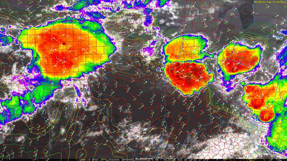
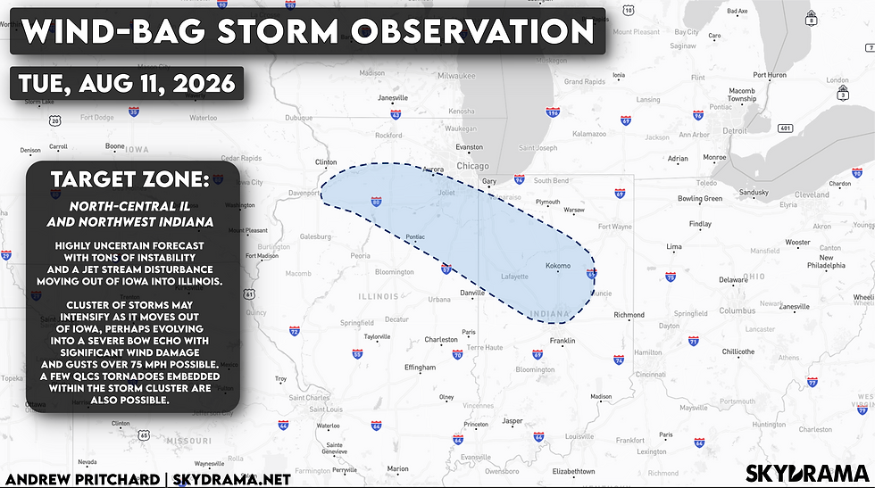
Broadly speaking the most likely scenario is for some intensification of the storms associated with this disturbance as they encounter the increasingly unstable air mass downstream across Illinois and eventually Indiana. What isn't clear is how intense this cluster of storms may become, and whether it would race east along Interstate 80 through the Chicago metro into northern Indiana, or track a little more southeasterly following the instability gradient into portions of north-central and central Illinois, eventually into northwest and central Indiana. What's also not clear is how much of a tornado risk may present itself, whether embedded within the line in QLCS fashion or with renewed storm development along a trailing outflow boundary at some point in the day.
I'm covering the forecast and sending out some early alerts from the weather desk here in Champaign-Urbana for a few more hours this morning, but I'll likely be headed out to intercept whatever erupts later today either as a curious observer or in live coverage/broadcast meteorologist mode should storms dive into east-central Illinois and the immediate C-U area.
We'll see... tons of uncertainty as of sunrise, but certainly feels like somebody gets hit hard by a significant severe storm across northern/central IL into northern/central Indiana today. The zone I highlighted above is my most likely domain for covering the storms but is certainly not illustrating the bounds on today's risk which is much more geographically expansive. Based on timing and terrain, this is just where I think the best opportunity to observe a significant severe storm will be focused mid-day into the afternoon hours.

