
Next Severe Weather Window Emerging for Early April From Texas to the Midwest
- Andrew Pritchard

- Mar 20
- 3 min read

Long-range guidance—while still fuzzy on the details—is beginning to hone in on the next potentially active stretch of storm systems across the Lower 48 east of the Rockies. While specifics remain limited, a general theme and region of interest are starting to emerge, so I wanted to put together a quick blog before getting swept up in a weekend of college hoops (go Illini!).
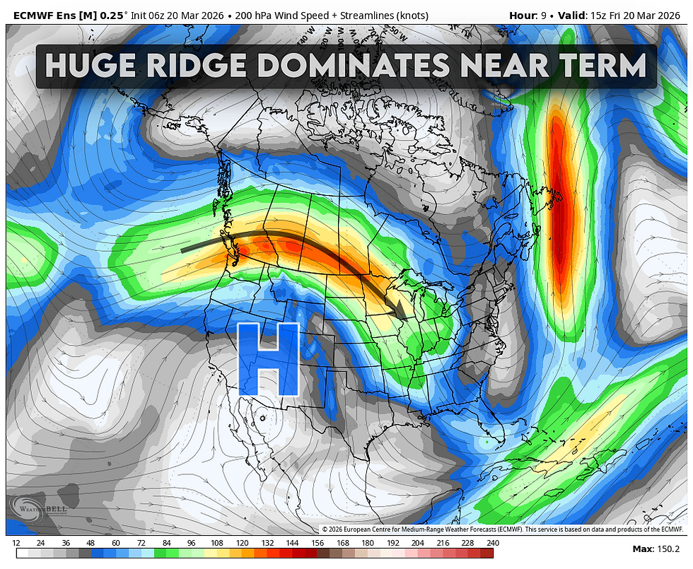
A dominant, record-breaking ridge will hold across the western U.S. through the end of March. At times, the ridge may flatten slightly as waves ride over the top and crash into the eastern U.S., but it will likely take another 10 days or so before this pattern breaks down as a primary driver. A couple of these cold fronts could bring one-and-done chances for scattered storms across portions of the Midwest and Ohio Valley, though these setups are not typically associated with significant severe weather or tornado outbreaks.
That said, a slight risk exists across parts of Indiana and Ohio on Sunday, with a low-end potential for a few supercells. A similar setup may materialize again around March 26 across portions of the Ohio Valley.


Beyond that, attention turns to late March and early April, when increasing influence from the subtropical jet stream may begin to take hold. Combined with the gradual eastward progression of the western ridge, this should allow Gulf moisture to return northward while opening the door to a more active storm track extending from Texas into the Great Lakes.


As a result of this pattern progression, global ensembles are trending wetter from Texas to the Great Lakes in early April:


There's research to support the idea that these transitioning La Niña years can be associated with an elevated risk for tornado outbreaks across portions of the Midwest and Southern Plains. Read this research here: https://iopscience.iop.org/article/10.1088/1748-9326/11/4/044008

Additionally, recent work examining the Madden–Julian Oscillation (MJO) has identified a correlation between high-amplitude progression from Phase 8 into Phases 1 and 2 and increased U.S. tornado potential.
Near-term forecasts do show some clustering around the MJO emerging into Phases 7–8 and then progressing toward Phase 1 over the next 2–3 weeks. While you can begin to see hints of that progression in longer-range guidance, the signal remains muddy at this point.


The purpose of highlighting these signals is not to overstate confidence, but to show alignment between global ensembles and broader climate-scale drivers. Together, they support the idea that we may be entering a new window of opportunity for severe weather from the Southern Plains into the Midwest in early April. Analog years have long suggested the potential for anomalously active periods across the Lower and Middle Mississippi Valley in late March and early April—2023 being a recent example during a transitioning La Niña.
That said, the current transition toward El Niño appears more rapid than typical over the past couple of decades. So while analogs provide a useful starting point, they are far from a perfect roadmap.
At a high level, the signal comes down to three factors:
ENSO is at least loosely supportive
The MJO may be trending toward a favorable phase progression
Global ensembles are beginning to reflect a more favorable background pattern in the Day 10–15 range
No need to overcomplicate it beyond that. We’ll revisit this early next week and see whether confidence is increasing—or if it’s back to the drawing board.


