
Local Windbag/ Tornado Observation Later Today?


Today is one of those days where I'm sitting at my desk sipping coffee, pretty darned sure I'm going to observe some sort of significant severe weather event within a few hours of my home, but I'm not at all sure what time I need to leave or where I need to drive.
The environment across southern Wisconsin, northern and central Illinois, southern Michigan, and northern Indiana is extremely unstable, and there are a handful of boundaries floating around from storms over the previous 12 hours, along with ongoing storms across Wisconsin and Michigan ahead of the approaching jet stream disturbance. All of this means there is plenty of fuel and enough shear for explosive severe thunderstorm development with a few high-precipitation supercells or high-end wind damage producing storm clusters, but very low confidence around when these storms may erupt and where they're most likely to do so. Days like this are often an hour by hour situation.
You watch the radar, visible satellite, and surface observations evolve watching for areas where you might have more favorable wind shear for a supercell storm mode, perhaps a boundary or modifying outflow regime... areas where the cumulus field is becoming more agitated, perhaps signaling imminent initiation of intense severe storms. You've got pick your area... your "man, if something goes here it could be really fun to observe" zone, and then watch for any sign of storms erupting in that zone, or perhaps erupting near and propagating into it.
As of 10 AM on Monday morning, northeast Illinois into northwest Indiana is that zone for me. Don't ask me to show my work too thoroughly, it's a bit of an imagination game, literally trying to imagine how things may evolve mentally vs relying on models. Watching things evolve this morning, I kind of think you may end up with a rather volatile environment across northeast IL and northwest IN with MLCAPE above 5000 j/kg, relatively strong southwesterly winds at the surface, and a branch of strong northwesterly flow over the top of it. I'm not sure if you get a true boundary draped through that zone, but I do think you end up with just enough low-level flow potentially feeding into an ongoing storm cluster to foster an isolated supercell or two ahead of, or along the western flank of the storm cluster dropping southeast through Indiana.
I'm in work mode at home in Urbana for now, but if compelled I could see myself drifting north or northeast from here during the afternoon hours. I'm not super confident I'm observing and documenting tornadoes today, but I feel reasonably confident in significant severe weather occurring through that storm observation target zone late this afternoon into the early overnight.
Big mean windbag? Tornado? A big ole' high-instability bust?
A few model snapshots, which are mostly worthless on a day like this:
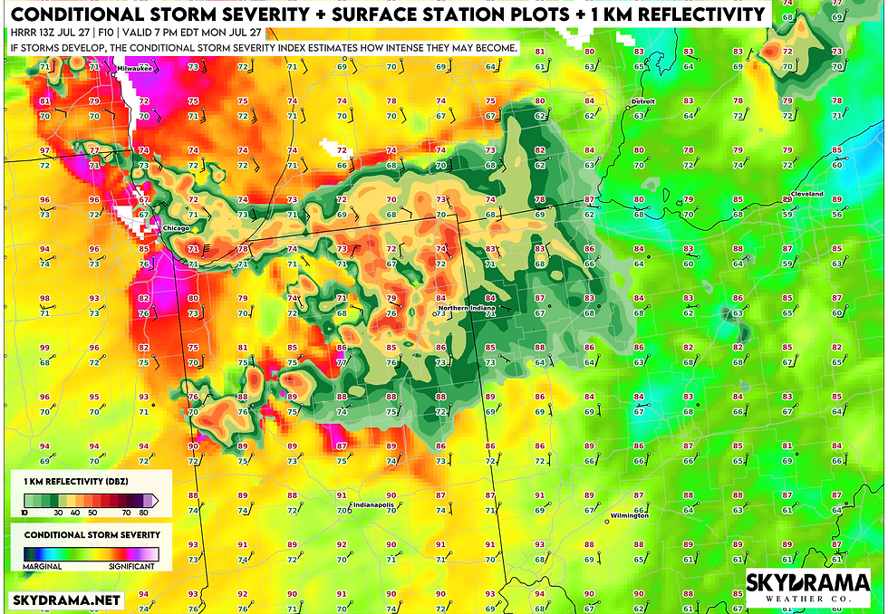
Conditional Storm Severity Index shows favorable conditions for significant severe weather, with a few of the early morning HRRR runs (13z shown) depicting discrete supercells along the western flank of the storm cluster near the Illinois/Indiana border.
This is a LOT of juice:

Run to run variability is quite high with respect to WHERE this occurs, but there's been a consistent signal for 70-80 mph wind gusts within the strongest storms across much of southern Michigan, Indiana, and western Ohio as storms surge southeast through the evening and early overnight hours:


