
A Few Severe Storms Expected on the High Plains
- Andrew Pritchard

- Oct 16, 2025
- 2 min read
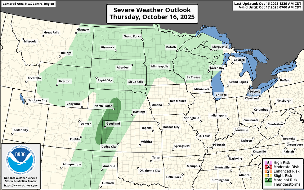
A sprawling upper trough over the western U.S. is sliding east today, sending a compact upper low across the central Rockies into the Dakotas. That means increasing mid-level flow on the order of 50 to 60 knots will overspread the central High Plains this afternoon, providing plenty of wind shear to help organize whatever storms manage to form.
A surface low over the western Nebraska–South Dakota border will drag a cold front east and southeast through western Nebraska, northeast Colorado, and northwest Kansas right around peak heating. Moisture isn’t impressive (dewpoints mostly in the low 50s), but deep mixing and temperatures in the upper 70s to low 80s will help squeeze out modest instability, just enough for a few robust updrafts to go up along the front by late afternoon.


Given the shear, any storm that develops could organize briefly, producing marginally severe hail and perhaps a few strong wind gusts. There’s even a subtle zone of backed surface flow near the CO–KS–NE border where low-level turning might allow for a very low-end tornado risk, though the front’s eastward shove should undercut most storms fairly quickly.
Farther north across the Dakotas, elevated storms ahead of the upper low could drop occasional small hail, but the more interesting setup for storm structure and photography will be down south along the High Plains boundary zone.
Bottom line: A marginal severe setup, classic fall High Plains flavor. Not a chase day for everyone, but perhaps a photogenic opportunity if you happen to be near the Colorado–Kansas–Nebraska corner at sunset.


